
-

Technical Guidance | Coaching with Dr. Kim
CoachingGet tailored feedback, strategic advice or help setting up your own systems. Whether you need a one-time session or mentorship support, book one-on-one time directly with me to fast-track your progress!
-

SkyTribe Drone Pilot Community
CommunityWelcome to the SkyTribe — Where we learn to fly & grow strong together! Join this global drone community & let's explore flying with purpose 🚁
-

UAS Policy & Operations Manual (Template)
Digital downloadSave time with my customizable UAS Operations Manual template—Perfect for ensuring compliance, safety, and effective data management in your unmanned systems operations.
Products
-
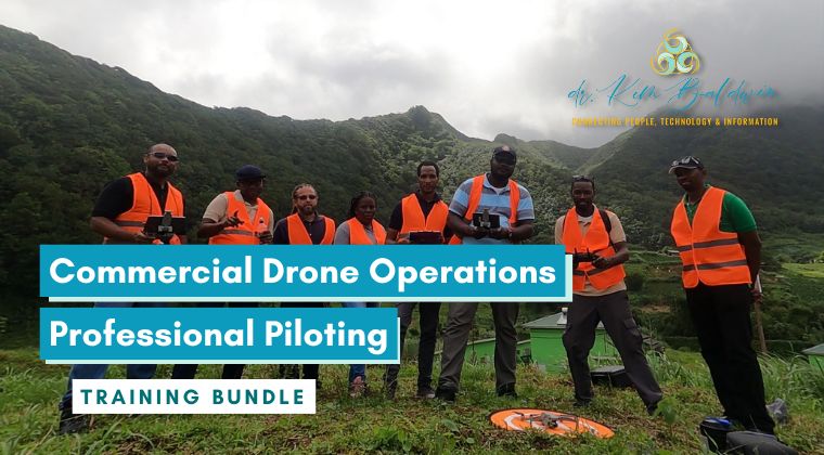
Commercial Drone Operations Professional Piloting Training Bundle
BundleDesigned for pilots ready to move beyond recreational drone flying!
This program includes policy, flight safety, international operational procedures & business-building tools & mentorship to help you fly smarter & start strong.
$1,500
-
Enroll Now – Launching Soon!

Starting a Drone Business | Mini Course
Course5.0 average rating (1 review)Drones are transforming industries worldwide. In this mini-course, Dr. Kim Baldwin shares practical, real-world guidance on starting a drone business—covering operations, compliance, workflows, and how to move from flying to professional services.
$150
-

DJI Mini 4 Pro Mapping Guide | 2025
Digital downloadDiscover how to leverage the DJI Mini 4 Pro for efficient aerial mapping. This guide covers specifications, setup, and tips for accurate environmental surveys and community projects.
Free
-

Participatory-UAS Mapping & Monitoring Strategies | 2026
CourseParticipants will be guided on the design and execution of Participatory-UAS drone mapping surveys for environmental monitoring.
-
.png)
Participatory-UAS Mapping for Environmental Monitoring | Webinar
CourseLearn to harness participatory drone mapping for environmental monitoring and stakeholder engagement. This course offers practical tools and techniques to create effective geospatial data and management plans.
-
.png)
Mavic3E Multispectral | Advanced Agricultural Mapping
Course5.0 average rating (3 reviews)Explore the Mavic 3 Enterprise Multispectral Advanced Features & DJI Pilot 2 App for large-scale, high-precision mapping missions. Acquire advanced flight skills, confidence using RTK positioning & techniques for capturing multispectral drone data.
Additional products & services
Create a custom package for your exact needs