
-

Technical Guidance | Coaching with Dr. Kim
CoachingGet tailored feedback, strategic advice or help setting up your own systems. Whether you need a one-time session or mentorship support, book one-on-one time directly with me to fast-track your progress!
-

SkyTribe Drone Pilot Community
CommunityWelcome to the SkyTribe — Where we learn to fly & grow strong together! Join this global drone community & let's explore flying with purpose 🚁
-

UAS Policy & Operations Manual (Template)
Digital downloadSave time with my customizable UAS Operations Manual template—Perfect for ensuring compliance, safety, and effective data management in your unmanned systems operations.
Products
-

Drone Start-Up Package
BundleA needs assessment will help you identify your applications & required data to develop high-potential case studies for your industry; all while training you how to apply commercial operational workflows so you'll operate using professional standards
-
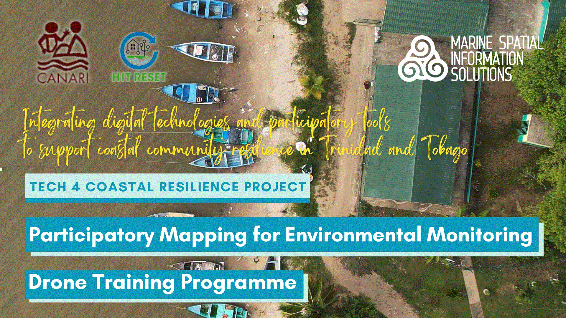
Participatory Drone Mapping for Environmental Monitoring Training Program
BundleThis is a participatory drone mapping surveys and geospatial data collection for environmental monitoring bundle. Teams are guided by applying real-world scenarios to plan and design a monitoring workflow to set up a national monitoring site.
-

PUAS Mapping & Analysis | Pilot
BundleThis comprehensive training package provides an overview of my signature 'Participatory Approach' to drone field surveys, mapping techniques from the design to the creation, data analysis, and sharing of information using web-mapping analysis tools.
-

PUAS Mapping & Analysis | Analyst
BundleThis training bundle provides an overview of commercial UAS operations, geospatial analysis, field survey exercises to create and share UAS geospatial data and information using web-based apps, geospatial analytic tools and IT tools.
-

Advanced UAS High-Accuracy Mapping Geospatial Analysis | Pilot
BundleThis comprehensive training package focuses on DJI Mavic 3M and Air2S for high-accuracy mapping, agricultural monitoring, and ecosystem data analysis. Includes flight planning, data assessment, and stakeholder collaboration.
-

Advanced UAS High-Accuracy Mapping Geospatial Analysis | Analyst
BundleThis intensive training package covers high-accuracy drone mapping, multispectral and geospatial analysis, field data collection, and GIS tools to produce ecosystem insights and support data-driven decision-making.
Additional products & services
Create a custom package for your exact needs