
Turn Your Drone Into a Tool for Real-World Impact
Learn how to fly, map and analyze with confidence through Dr. Kim Baldwin’s global Training Academy — designed for professionals in environmental management, agriculture & conservation
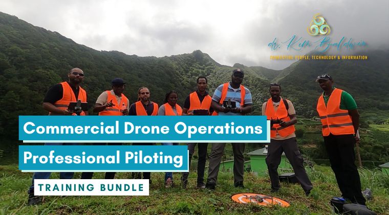
Enroll Today
Designed for pilots ready to move beyond recreational drone flying!
This program includes policy, flight safety, international operational procedures & business-building tools & mentorship to help you fly smarter & start strong.
PurchaseConnecting People + Technology + Information
As the Founder and Director of Marine Spatial Information Solutions (MarSIS) Inc., I’ve built a career around one core mission: empowering people to use participatory approaches together with drones & geospatial tools to make data-driven, real-world impact.
Through my Training Academy, I’ve taught hundreds of individuals and organizations how to safely & professionally operate drones, conduct drone mapping missions, collect accurate environmental data and analyze and share their results for agriculture, fisheries, conservation and disaster management. My Participatory-UAS approach brings together science, technology and collaboration — ensuring that every learner, regardless of background, can build confidence and contribute to smarter environmental decision-making.
Whether you’re an individual seeking new skills or an organization building technical capacity, my goal is to make drone technology accessible, practical and transformative. Together, we can learn how to use technology tools to help us protect our planet and strengthen the communities that depend on it.
Come Fly With Me Today!
Marine Ecologist | Drone Educator | Geospatial Innovator
My courses have been applied by a variety of industries, applications & end-users


My mission is simple - to make drone & geospatial technology accessible, accurate & empowering!
For most of my courses — yes, having a drone capable of mapping is essential to get the full hands-on experience.
However, if you’re brand new to flying, start with the Drone Flying Fundamentals Mini Course. It’s designed to help you understand recreational drone flying basics, flight safety, and setup of your first drone — very useful to take even before investing in a new drone!
These courses are designed for professionals, students, and organizations who want to use drones and geospatial tools for real-world environmental management — from agriculture and fisheries to coastal conservation and disaster response.
Whether you’re a complete beginner or an experienced pilot expanding into professional mapping, there’s a clear learning path for you!
No worries! All of my courses are hosted using Thinkific online learning dashboard, where you can watch courses whenever it suits your schedule. You’ll also have access through the Thinkific mobile app, so you can learn on the go & revisit course resources 24/7.
All courses include a Certificate of Completion, issued through my integrated partnership with AirData UAV. Certificates can be shared publicly on your AirData profile or LinkedIn, showcasing your verified skills in drone operations, mapping, and environmental applications.
The start dates for my courses vary as they are run as 'cohorts'.
My Commercial Drone Operations course is offered quarterly & Participatory-UAS Mapping & Monitoring flagship will be offered in Spring of 2026 & will be run twice a year. By subscribing to my mailing list you'll be among the first to know when the next cohort begins!
Depending on the specific course, we may be using drone mapping and/or geospatial software. The good news is that most of these software packages offer free evaluation trial periods that you can use during the course, allowing you to explore their functionalities without any additional cost.
Absolutely! I understand that every person and organization have unique needs and preferences. Therefore, I offer the flexibility of private in-person training courses that can be tailored to your specific requirements and available budget. These courses can be conducted at your location, ensuring convenience and personalized attention for your team.
Contact me for more information regarding in-person training and group discounts. I will work closely with you to understand your organization's goals and design a training program that aligns perfectly with your needs.
Yes, I understand that financial considerations are important, and I offer payment plans are offered via Klarna, AfterPay and Apple Pay to make the training accessible to a wide range of individuals. Please contact me if you have a financial hardship.
Additionally, I provide discounts for non-profit organizations, community groups, and youth. I am actively seeking funding opportunities to support a limited number of scholarships. Please contact me to explore potential avenues for financial support.
Let's start working together today!
Be among the first to receive information about new courses, exclusive offers, industry insights & drone tips from the field!
Don't miss out on this free learning opportunity to enhance your knowledge and skills in drone geospatial environmental mapping and monitoring. Sign up today!


