Empower Your Sargassum Management Efforts
Sargassum Monitoring Protocol using Drones: A Practical Guide Coastal regions across the Caribbean and West Africa have faced increasing challenges due to massive sargassum influxes, impacting ecosystems, fisheries, tourism, and local economies. The Sargassum Monitoring Protocol (SMP-Drones) provides a standardized, efficient, and accessible approach to quantifying and tracking sargassum stranding events using drone technology. Understand the impact of sargassum influxes on coastal ecosystems and communities. Learn how to conduct drone-based sargassum monitoring using standardized flight plans and field protocols. Gain hands-on experience in data collection, processing, and visualization using DroneDeploy and GIS tools. Develop skills to analyze sargassum beaching trends and support environmental decision-making. Learn best practices for stakeholder collaboration and information sharing for regional sargassum monitoring. The SargAdapt Good Practice Guide Series Vol. 1 2022, is designed for coastal managers, researchers, policymakers, and entrepreneurs looking to implement data-driven solutions for sargassum management. You will learn a step-by-step drone survey method, field measurement techniques, and automated geospatial analysis tools to support sargassum monitoring, mitigation, and forecasting efforts.
Sargassum Drone Monitoring Protocol Explained
Join Dr. Kim Baldwin, an esteemed drone mapping expert, on a voyage through 5 years of dedicated research. Experience her innovative method for monitoring sargassum abundance and improving sargassum management in the Caribbean. In this 10-minute presentation from the 3rd Sargassum Symposium, Dr. Kim presents the Sargassum Monitoring Protocol (SMP-Drones)—a standardized approach enhancing data collection and national management strategies. Explore the integration of this method into regionally, enhancing sargassum response strategies. Discover the transformative impact of drone technology on sargassum management!
Enhancing Sargassum Monitoring with Drones ✈
Standardised Sargassum Monitoring Methodology
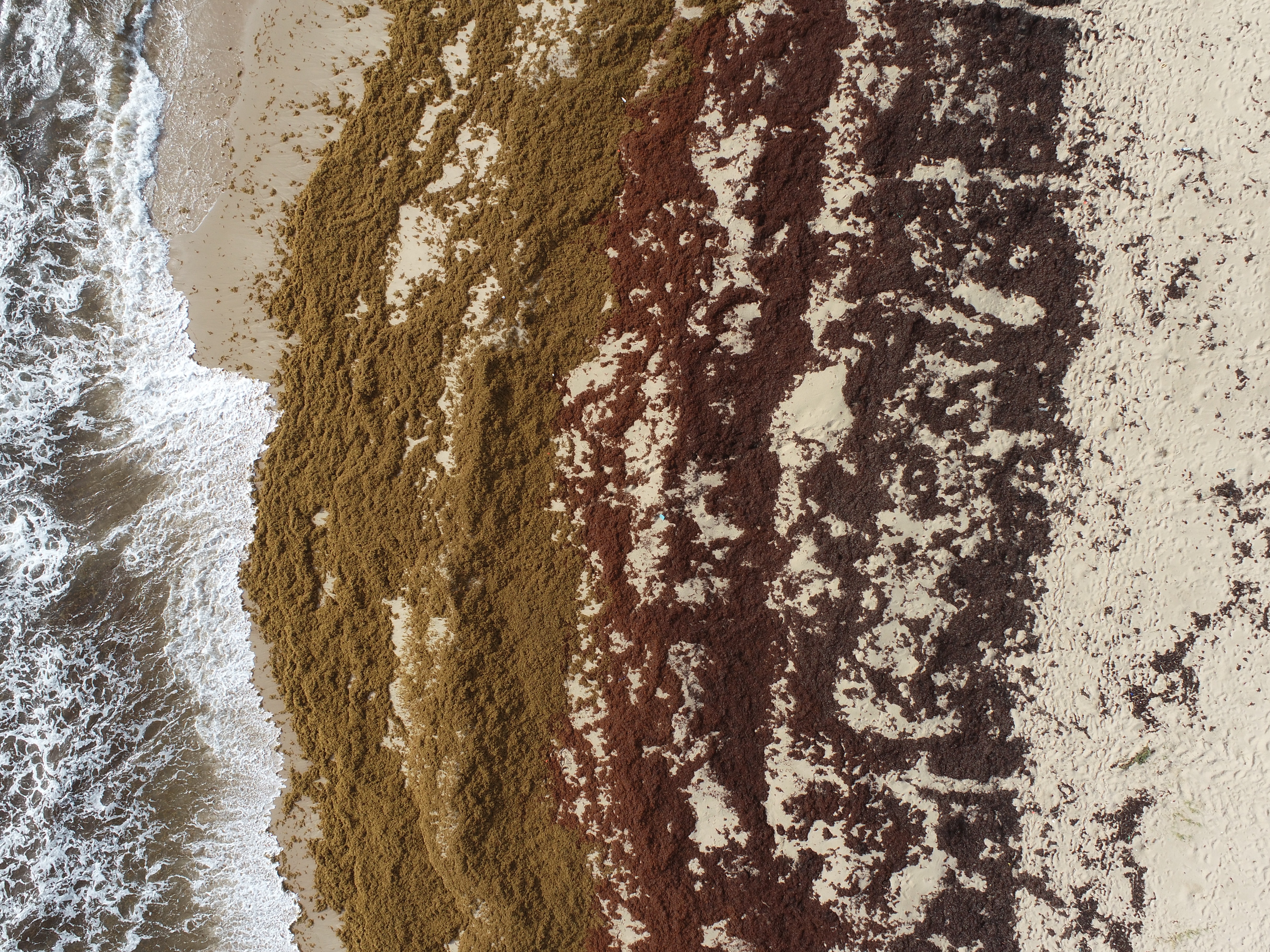
This guidebook provides a simple monitoring protocol using off-the-shelf drone technology that requires no specialised expertise, enabling widespread participation in standardised sargassum monitoring across the Caribbean.
Aids Decision-Making for Sargassum Management
Drone technology allows for real-time, accurate data collection, helping to validate sargassum forecasts to improve national and regional decisions for improved management of sargassum influxes.
Regional Collaboration & Capacity Building
Promotes collaboration across Caribbean nations through standardized sargassum data collection. Empowering local stakeholders to effectively manage sargassum for long-term sustainability.
Elevate Your Sargassum Monitoring Efforts
Take the first step towards enhanced sargassum monitoring and management using drones.
Download the Sargassum Monitoring Protocol Using Drones Guidebook Now

Dr. Kim Baldwin
I'm a marine ecologist and drone pilot with over 13 commercial licenses and two decades of research experience in the Caribbean, conducting environmental mapping, monitoring field research and teaching. My mission is to empower individuals and organizations with the skills and tools to navigate environmental data effectively. I've had the privilege of training numerous professionals and organizations across theworld in drone operations, geospatial mapping strategies for a variety of environmental management applications. Whether you're an individual, a small business, or a larger organisation, I'm here to help you harness technology to enhance your workflows!